Gray Fox’s Hunting Territory?
by William C. Leikam
President, CEO & Co-founder, Urban Wildlife Research Project
"Let our work lift this planet from its present illness" - WCL

Not long after the pair of gray foxes Laimos the male and mate Big Eyes as I have named them, came into the Matadero Creek region, I noticed that they continually increased their home range and hunting regions. They began along the southern border of Matadero Creek, then about a year later they began hunting over on the northern side and out into the marshlands and brushy areas. I knew when the foxes were moving on their nightly hunting forays from the south side where they have their den to the north side because I found a tree that had fallen across the creek and all the critters including the opossums and woodrats used it to go from one side of the creek to the other. I set up a trail camera pointed at that fallen tree.
I assumed that when they crossed that they picked up the Adobe Loop Trail, followed it to the split in the trail where one-part branches off slightly left and the other makes a sharp right turn. They would trot off onto the left-hand trail, go up and over the hill and down onto perimeter road. In that way, they’d travel the shortest route of 1.43 miles to the water treatment plant. (Google Earth measurement as marked along roadways, etc.)
They spent month after month crossing that tree-bridge, but then gradually I noticed that they’d miss a night and fail to cross over. The number of nights that they didn’t cross at the tree increased until they no longer used it at all and yet, I’d see them on my trail cameras hunting in the vicinity of the water treatment plant.
I put the question to my field assistant Christine Lopez. “How do those two foxes get from here in the overflow channel to the water treatment plant without using the crossing tree bridge?” She wasn’t sure but suggested that maybe they used the Matadero Creek Bridge. I had thought that too and so one afternoon in October 2022 we decided to walk the eastern edge of the largest Emily Renzel Ponds in search of scat. We found three or four deposits of old gray fox scat along the way and including possible trails leading off across the Emily Renzel Wetlands.
The solution to this unsettled issue came early one morning when Christine and I had just finished swapping out SD cards in camera #13. I turned back toward the channel and there, walking from the Bridge Trail onto the overflow channel, came Laimos.He stood there sniffing the air for our scents. Once he had identified us, he trotted on ahead down the channel, crossed to my right and up onto the retaining wall. He crossed the ditch on the wall, jumped down and he trot off toward marker #17.
That sealed my suspicions that the gray foxes hunted over around the Emily Renzel Ponds and then crossed the wetlands over to the region around the water treatment plant. I suspect that’s their track and the reason why we haven’t seen them crossing Matadero Creek via the crossing tree. If so, they travel about 1.94 miles one way, according to Google Earth. That means that their hunting foray for one night is a round trip of approximately 3.88 miles.
Section II
Update for the Urban Wildlife Research Project
Available Now: Bill’s book The Road to Fox Hollow has been released and can be found at Barnes & Noble Booksellers and directly from the publisher Di Angelo Publications.
Available Now: Learn more about Bill’s work with the foxes in The Foxes, My Professors, a video documentary produced at Stanford University by Syler P.R.
Dr. Marc Bekoff has an interview with Bill and that can be accessed at The Social and Emotional Lives of Urban Gray Foxes .
Bay Nature Magazine – “How to be a Fox” The article about Bill and his ethological approach to his study of the gray fox is online here. Many are calling this a major article in the wildlife press.
BE SURE TO check out our YouTube Channel for some incredible wildlife videos at and our Facebook page.
See Discipline Raccoon Style here.
Bill has an additional live event coming up at Los Altos High and Safari West in October. He will be live at Safari West https://www.safariwest.com/ in the Elephant Room, so if you’ve never been to Safari West, come on up for the day and hear Bill from 7:00 – 8:00 PM.
Undoubtedly the best Radio interview ever – KALW (PBS program Crosscurrents) – by Sofie Kodner during December 2020 – Broadcast 1/11/2021 5:00 PM. Check it out here.
You can access Bill’s PowerPoint presentation Corridors & Connections: Sustaining the Health of All Wildlife presented during the October 24th P-22 Urban Wildlife Festival here.
NEW – To find out more about us, search Urban Wildlife Research Project, UWRP, gray foxes, wildlife connection, linkages, corridors, and several documentaries including the video clips.
Gray Foxes General Health
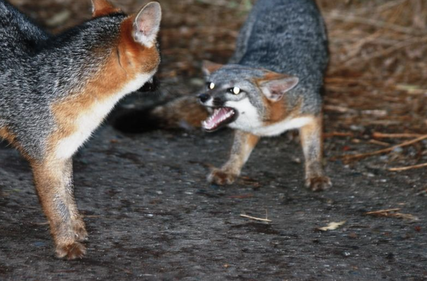
These two foxes appear to be in good health.
Total Numbers of Gray Foxes in the Palo Alto Baylands Nature Preserve: As of this date, we have two adult gray foxes living in the Palo Alto Baylands Nature Preserve.
Section III
Gray Fox, Baylands Goals
Within the permit that allows the Urban Wildlife Research Project to conduct its study of the behavior of the gray fox at the Palo Alto Baylands Nature Preserve, the objectives covered area:
- Monitoring of urban gray fox Denning sites in Palo Alto Baylands.
This is being accomplished during the period when the gray foxes use a den site. It is one of the prime locations for gathering most of the behavioral data of the litter and for adults alike.
- Assessment of status and population trends of Baylands urban gray foxes
Since January 2019 a pair of resident gray foxes have claimed territory at the Palo Alto Baylands Nature Preserve.
- Identification of habitat features that promote the presence of urban gray foxes
After considering this and talking with people who know how to restore habitats, we need to assess what kinds of plants, including the Alkaline Salt Bush, would grow best along the edge of the saltwater channel and alongside the marsh. We need to grow a permanent habitat that contains the corridors and plant it as soon as possible. We’ll keep an eye on this as this is a critical link between the southern region of the Baylands and the northern region.
- Assessment of reproductive success and identification of factors that promote successful reproduction
Open up the pinch-point along Matadero Creek by developing thickets that link one area to another, instead of the present “islands”.
- Identification and assessment of possible dispersal travel routes.
Presently there can only be guesses as to dispersal travel routes. We intend to make this important question much more concrete when we attain our collaring/take/capture permit from the Department of Fish & Wildlife.